


From 530 Runners to a Sell-Out: Ten Years on the Trails of Toohey Forest

When runners line up for the sold-out Toohey Trail Run, they will be taking part in an event that looks very different from the one that began in Toohey Forest with 530 runners.


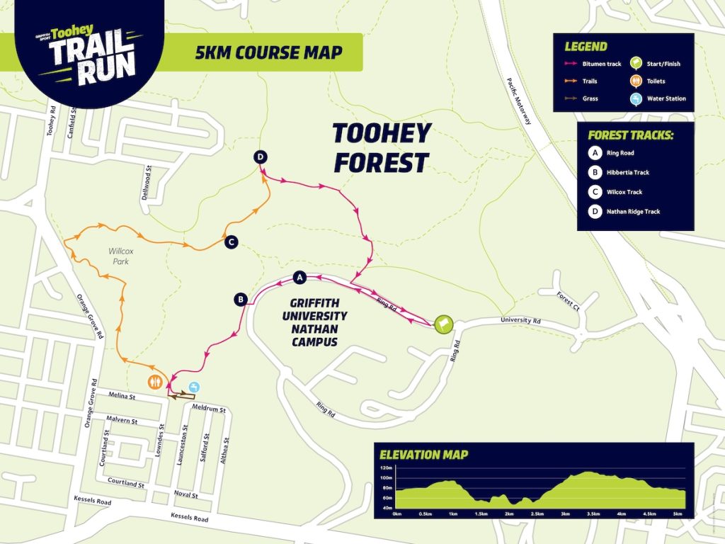
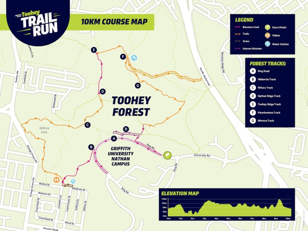
The 10th anniversary event will be held on Sunday, 20 September 2026, starting from Griffith University’s Brisbane South campus before heading into Toohey Forest. The half marathon begins at 6:30 a.m., followed by the 10 km at 6:45 a.m. and the 5 km at 7:05 a.m.

Every distance has sold out, continuing the growth of a race that began in 2015 with just two courses.

A Small Beginning in 2015

The inaugural Toohey Trail Run offered 5 km and 10 km courses between Griffith’s Nathan campus and Toohey Forest. More than 500 runners took part. Griffith later recorded the field at 530, giving organisers an early indication of demand for the event.

By the following year, a half marathon had been added. Organisers were aiming for more than 1,000 competitors, with about 400 registrations already received before race day. The three-distance format later became a fixture.

In 2018, registrations reached 1,082, then the largest field in the event’s history and a 10 per cent increase on the previous year.

Photo Credit: Griffith University

Powerful Owl Habitat Put Limits on Growth

As participation increased, organisers also placed limits on some race fields.

In 2017, the combined field for the 10 km and half-marathon races was capped at 800 competitors because those routes passed through habitat used by the Powerful Owl.

The 5 km field was not subject to the same restriction because its course did not extend as far into the forest. Organisers said the longer routes had been designed to reduce disruption to the owl’s woodland and watercourse habitat.

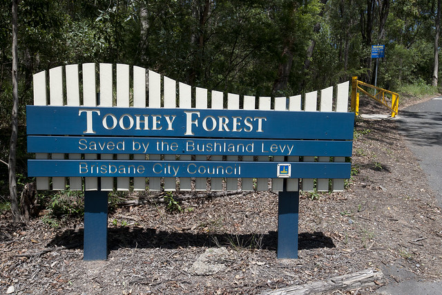
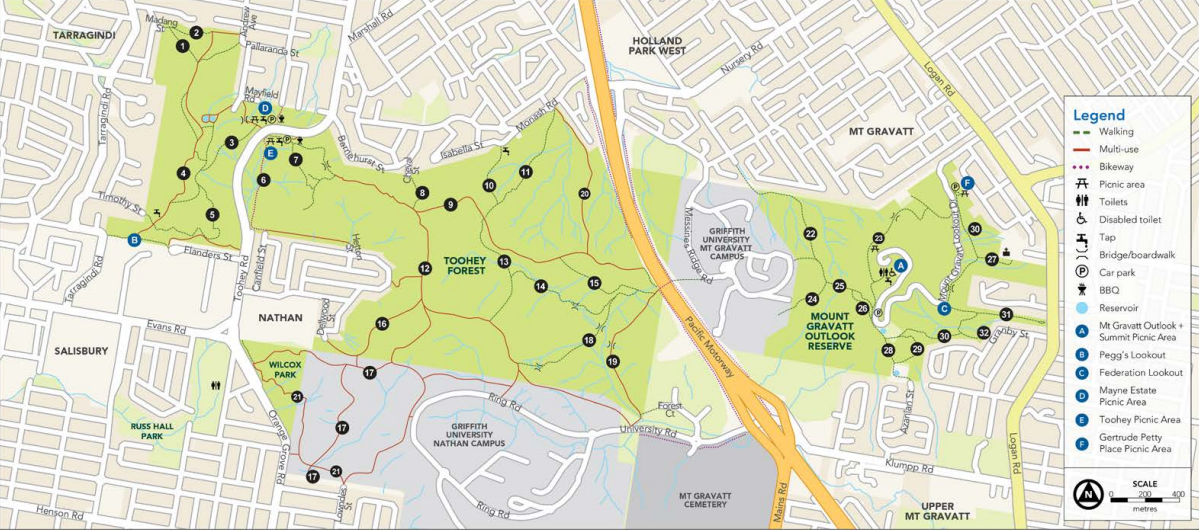
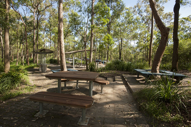
Toohey Forest Park covers about 260 hectares around 10 kilometres from Brisbane’s CBD. Brisbane City Council lists walking tracks, shared trails and picnic areas across the reserve, with connections to Mount Gravatt Outlook Reserve and Griffith University.

Across Toohey Forest Park and Mount Gravatt Outlook Reserve, Council records more than 400 species of native plants and wildlife, including koalas, echidnas, possums, gliders, frogs, bats and owls. Around 30 walking tracks extend across the two reserves.

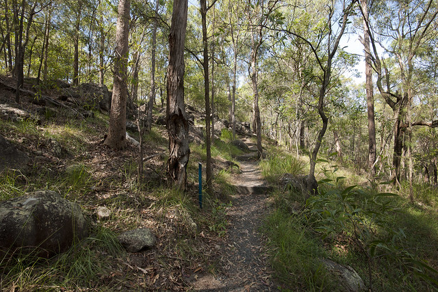
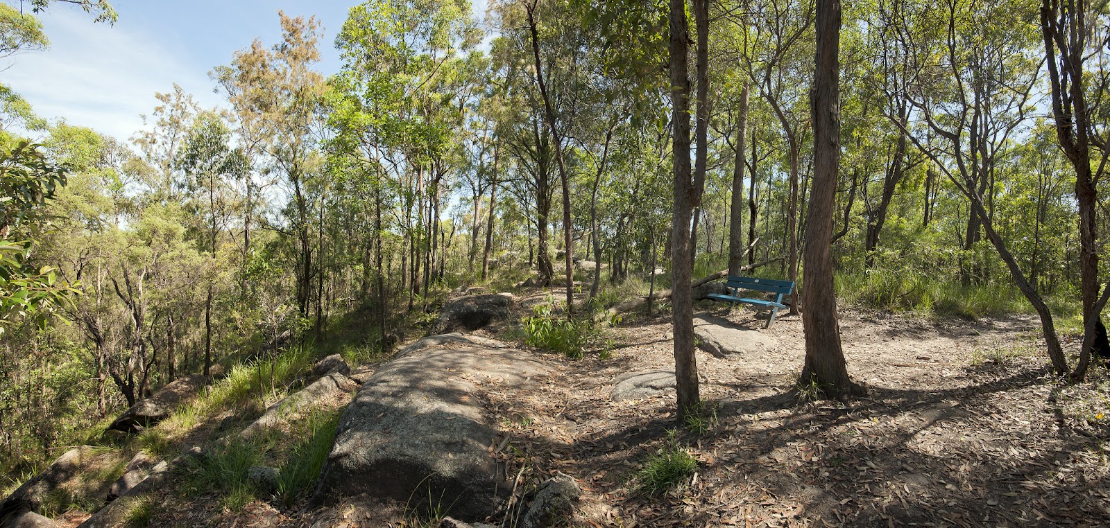
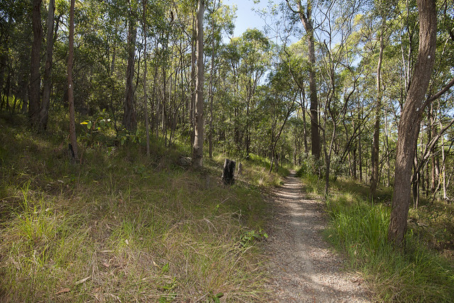
The race has continued on trails that are also used for everyday recreation while forming part of an important urban bushland habitat.

Photo Credit: Griffith University

A Break, Then More Runners

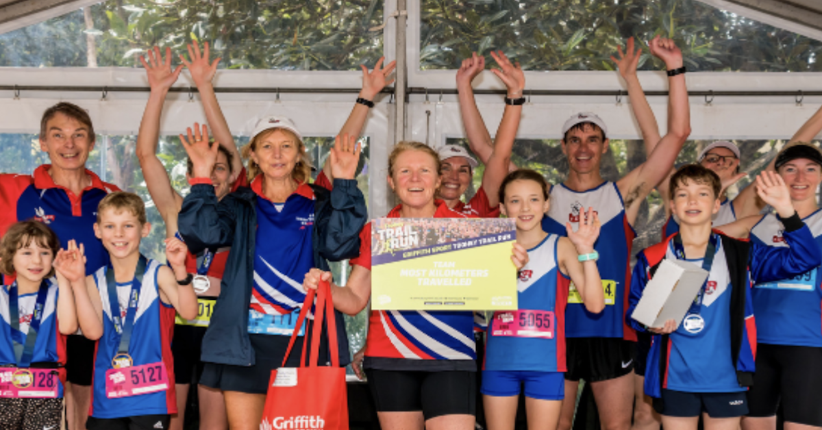
The event was not held in 2020 during the COVID-19 pandemic. It returned in 2021 with more than 830 participants across the 5 km, 10 km and half-marathon courses. By 2025, participation had reached 1,252 runners, including 272 in the 5 km, 573 in the 10 km and 407 in the half marathon.

Griffith recorded the half-marathon field as the largest in the event’s history, with competitors ranging from five to 77 years old.

Fundraising Grew Alongside Participation

The trail run has also developed a fundraising component. The 2018 event raised more than $6,500 for Diabetes Queensland. In 2025, Griffith recorded $13,150.69 raised in support of Diabetes Australia.

Race-day operations have changed as well. The 2026 event will again operate without disposable drinking cups at water stations, requiring competitors to carry a bottle, hydration pack or collapsible cup. A limited-edition collapsible cup was offered to the first 1,200 people registered for the anniversary event.


Back to the Starting Line

The race precinct is scheduled to close at 10:30 a.m., several hours after the first competitors leave the starting line.

From 530 runners and two distances in 2015, the Toohey Trail Run has grown to three established courses and more than 1,200 participants at its most recent event. Its 10th anniversary race now arrives with every distance sold out, returning runners once again to the trails that gave the event its start.

Published 15-Sept-2026

Toohey Forest Was Treated for Fire Ants in April – What Happened Next?

Five months after aerial fire-ant treatments were carried out in Toohey Forest, official eradication records show broad regional progress across Brisbane, though park-specific outcome data remains unpublished.


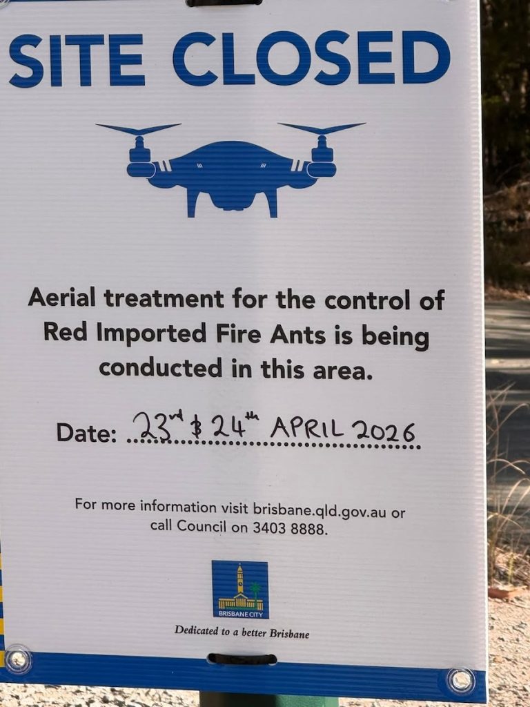
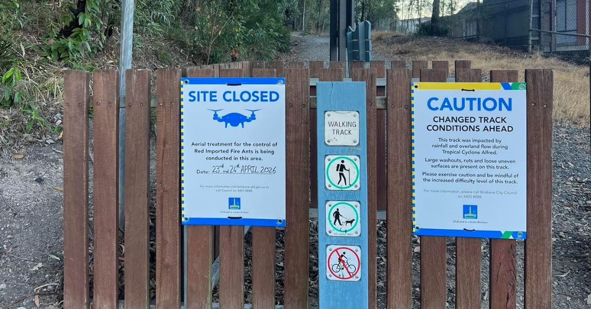
Signs at the Davey Street entrance alerted residents to the fire-ant response in April, with aerial treatment scheduled for 23 and 24 April. Brisbane South BUG reported that Brisbane City Council had advised drones would be used to distribute bait during the operation.

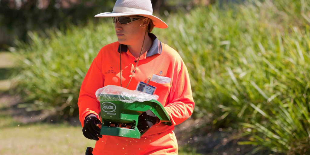
The National Fire Ant Eradication Program uses drones, helicopters and aeroplanes for properties larger than five hectares, while smaller sites can be treated with utility terrain vehicles or handheld spreaders. 

Public map no longer shows a Toohey Forest marker

A current view of the National Fire Ant Eradication Program’s public detection map shows no confirmed detection marker over Toohey Forest as of September 2026.

Photo Credit: fireants.org.au

The map is updated daily with detections confirmed by the program. Confirmed infested locations remain visible for 12 months regardless of whether treatment has taken place, and each location can represent more than one nest. The map does not show total nest numbers or treatment outcomes.

Because the Toohey Forest treatment occurred only in April, the absence of a marker is notable, but it does not establish that the infestation has been eradicated. 

Broader aerial treatment reports strong reductions

Statewide figures released in July show substantial reductions in some treated areas.

The Queensland Government said more than 185,000 hectares had received aerial treatment across seven local government areas, including Brisbane City. Fire ant populations had fallen by an average of 86 per cent in some of the most heavily infested areas covered by the suppression program.

An August update from the Invasive Species Council said fire ant numbers were falling sharply in treated areas and 208,000 hectares had recently moved from suppression towards active eradication. The group also said Queenslanders were checking for fire ants at 13 times the usual rate.

Broader South East Queensland results show aerial suppression reducing fire-ant numbers in some heavily infested areas. A comparable result for Toohey Forest has not appeared in the official updates reviewed.


Toohey Forest supports threatened wildlife

Griffith University’s 175-hectare Nathan campus forms the southern part of Toohey Forest and contains remnant native vegetation and several regional ecosystems.

University records list more than 500 native animal species at the campus, including endangered koalas and threatened species such as powerful owls, glossy black-cockatoos, grey-headed flying foxes and tusked frogs.

The forest and adjoining campus also provide public green space and tracks used for walking and cycling.

Published 15-Sept-2026

Uncovering History: Toohey Forest’s Hidden Past

Toohey Forest, a tranquil retreat known for its ecological significance and scenic beauty, was the site of a significant discovery of artefacts in the late 19th century. Over one hundred years later, a new round of efforts are being made to uncover the story behind that discovery.


The Indigenous Significance

Toohey Forest, a part of the Brisbane area known as Meanjin to the Turrbal and Yuggera Peoples, is rich in Indigenous history. This land was home to abundant natural resources and served as a hub for traditional activities. From hunting and crafting using the local fauna to spiritual and ceremonial practices, the forest was integral to the Indigenous way of life. 

Even in the post-European settlement era, indigenous people continued their traditional practices in the forest, albeit with increasing challenges due to displacement.

The Discovery by George Thomas McDonald

In the late 19th century, a significant discovery was made by George Thomas McDonald, a surveyor and farmer. While exploring Toohey Forest, McDonald stumbled upon a cave that housed a collection of ochre-painted human bones, alongside stone and shell knives. 

Mr McDonald, who was born in Scotland in 1835 and later settled in Brisbane, played a pivotal role in bringing these historical pieces to light. He passed away on 29 Jan 1915  in Wynnum at the age of 79. 

Since then, the artifacts have been carefully preserved and later housed at the Queensland Museum.

Recent Developments and Research

Fast forward to the 21st century, and these artefacts have once again sparked interest. The Annerley Stephens History Group is leading the charge and recently organised a conference to delve deeper into the nature and history of the artefacts.

The event aimed to shed light on the local history, with a focus on the First Nations’ heritage. A key aspect of the conference was to discuss the significance of these artefacts and their connection to the local Indigenous people. 

Annerley Stephens History Group
Photo Credit: Annerley Stephens History Group

With the consent of Aboriginal elders, a thorough examination of these artefacts has gotten underway to determine their age and deeper historical context.

Toohey Forest Today

Today, Toohey Forest stands as a testament to Brisbane’s rich and diverse history. It is not only a natural sanctuary but also a bridge connecting the present to the past. The discovery of these artefacts has opened a new chapter in understanding the Indigenous heritage of the area, offering insights into the lives and practices of Australia’s First Peoples. 


As research continues, Toohey Forest is poised to reveal more of its hidden stories, enriching our understanding of the land and its original inhabitants.

Published 14-Nov-2023
Updated 15-Aug-2026

Toohey Road Set for Upgrade Under Brisbane’s Operation Smooth

Toohey Road in Salisbury is among the roads included in a $110 million resurfacing program covering almost a million square metres of road surface across Brisbane, with the works branded “Operation Smooth” forming part of a broader $1.9 billion transport and infrastructure package for the coming year.


For Tarragindi and Salisbury residents, the resurfacing arrives on a road that has already seen significant recent investment of a different kind, just metres from where koalas and other wildlife now cross safely beneath the bitumen.

A road that runs through Toohey Forest

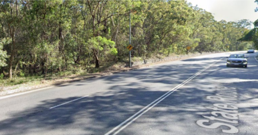
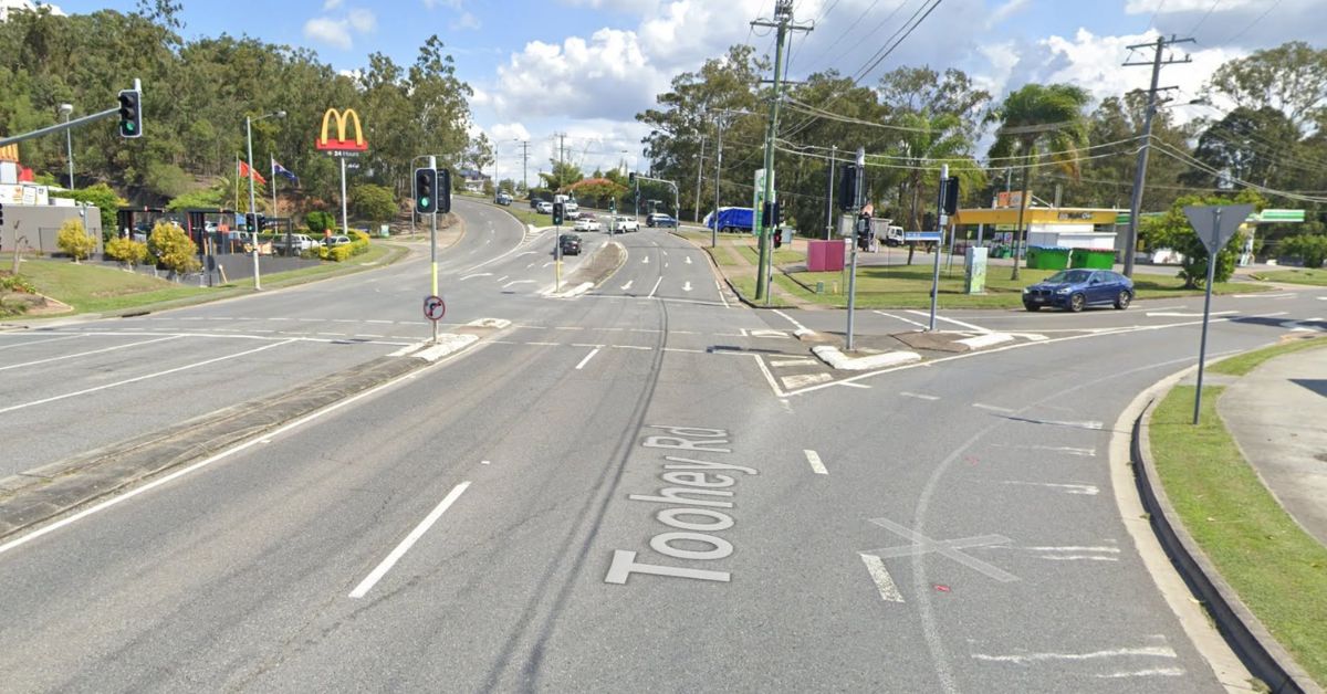
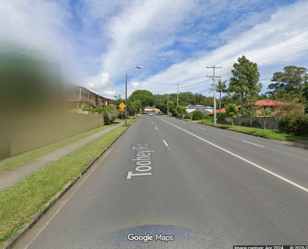
Toohey Road carries traffic along the edge of Toohey Forest, one of Brisbane’s most significant urban bushland reserves and home to a resident koala population that has long faced the basic problem of needing to cross a busy suburban road to move between habitat areas.

Photo Credit: Google Maps

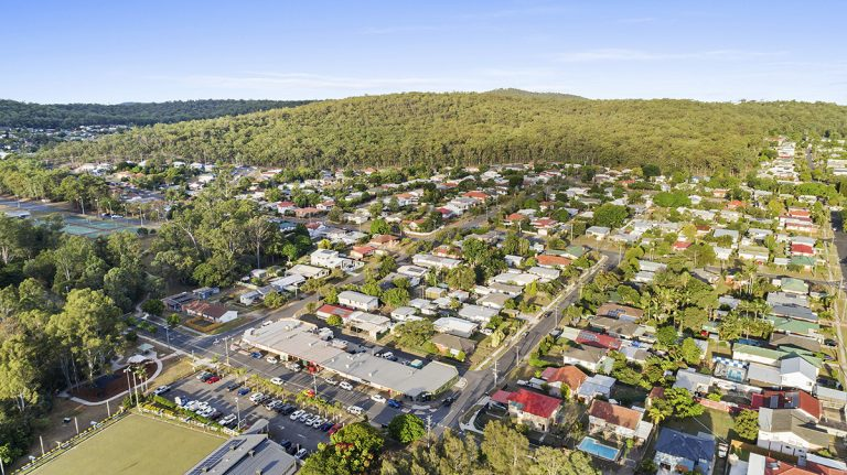
Salisbury sits roughly 12.4 kilometres south of the Brisbane GPO, with Toohey Mountain and its surrounding reserve forming the suburb’s north-eastern boundary.

Photo Credit: Mark Ward Property

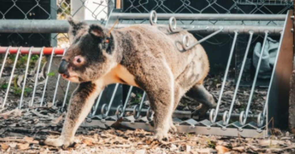
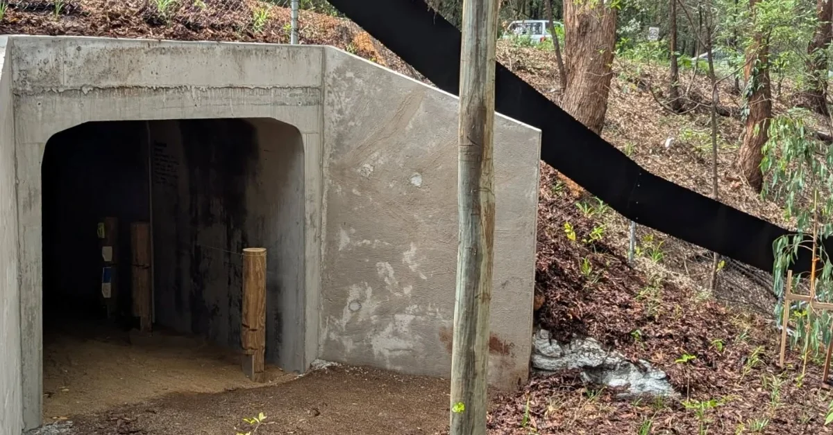
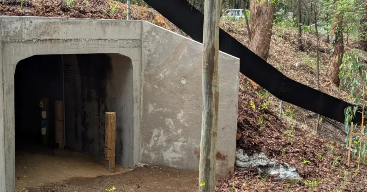
A purpose-built wildlife underpass on Toohey Road was completed recently, giving koalas and other native animals a dedicated, safe crossing point beneath the road rather than forcing them to navigate traffic at ground level.

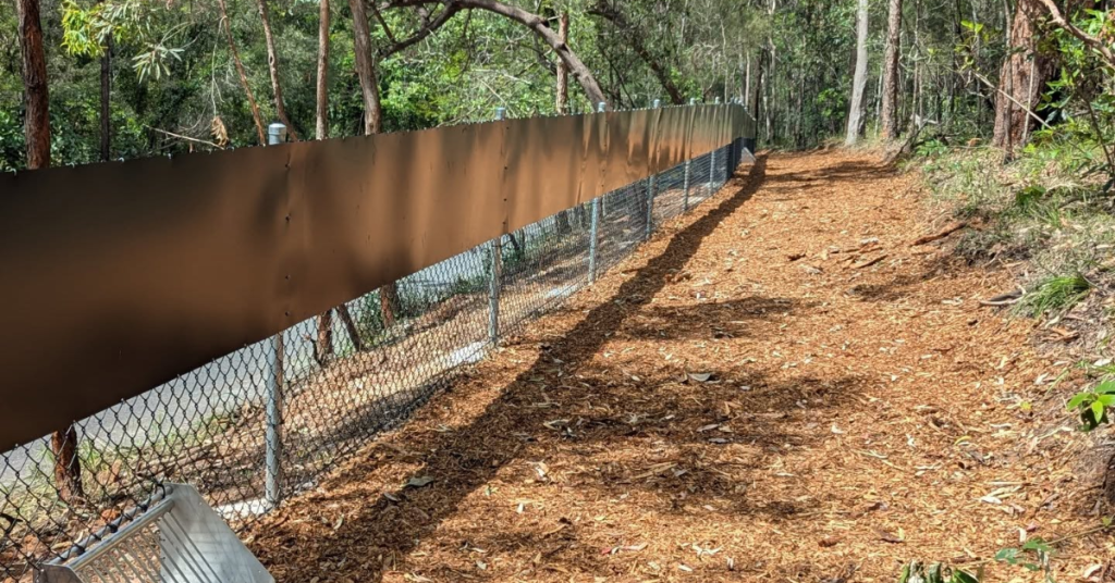
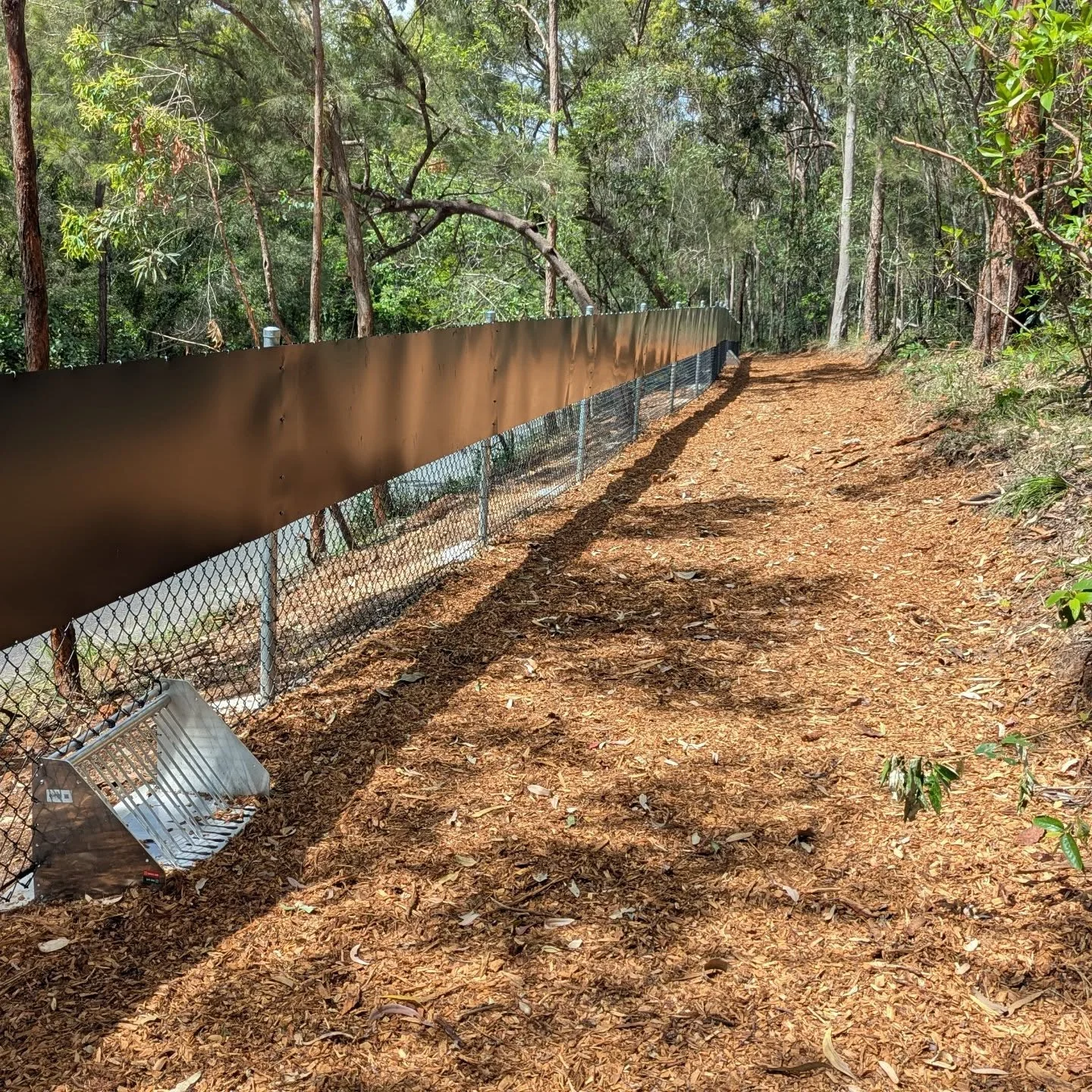
The project involved installing fencing fitted with wildlife escape hatches on either side of the underpass to guide animals toward the crossing, along with mulch and natural material placed at the base of the culvert to encourage use and help the structure blend into the surrounding habitat. Some minor finishing touches around the site were completed in early 2026.

The resurfacing works now planned for Toohey Road sit alongside that wildlife infrastructure, meaning the road corridor through this stretch of Salisbury has had a genuinely active year of construction activity, addressing both surface quality for motorists and safe passage for the animals living in the forest beside it.

Connecting suburbs, commuters and bushland

Toohey Road functions as a key connector for residents and commuters travelling between Tarragindi, Salisbury and the broader southern Brisbane network, linking through to Toohey Mountain Reserve and onward toward Sunnybank and Macgregor.

Photo Credit: BCC

Bus route 120 runs along the corridor, connecting Garden City to Brisbane City, with a stop directly at Toohey Forest that has seen its own temporary adjustments during the underpass construction period.

The combination of through-traffic, bus services and proximity to bushland recreation areas makes Toohey Road a road that genuinely earns its place in a resurfacing priority list, carrying enough daily use to justify the investment in a smoother and safer surface.

Next steps for the project

Brisbane’s standard approach to resurfacing involves advance notice to residents and motorists before works begin, with councils typically flagging in advance whether disruption will include night works, temporary lane closures, reduced speed limits or vehicle relocation requirements. A detailed construction schedule for Toohey Road has not yet been released, so the exact timing and duration of works remains to be confirmed.

Once complete, the resurfacing is expected to deliver a smoother, safer driving surface on a road that already represents one of Brisbane’s better examples of balancing traffic infrastructure with wildlife conservation in the same stretch of bitumen.

For updates on roadworks and closures, residents can check QLDTraffic’s live traffic alerts or click here.


Published 17-June-2026

Fire Ants Discovered in Toohey Forest, Control Measures in Action

Signs posted at the Davey Street entrance to Toohey Forest in Tarragindi confirm that fire ants have been detected in the reserve, with eradication treatment now underway as part of Australia’s national effort to rid the country of one of its most dangerous invasive species.


A community member spotted the warning sign at the Davey Street entrance on 17 April, prompting questions among locals about what treatment was being used and whether households bordering the forest would receive more information.

The signs themselves are a standard part of the National Fire Ant Eradication Program‘s response procedure, posted to alert visitors that baiting or treatment activities are active in the area.

While fire ants in a beloved green space like Toohey Forest are understandably concerning, the presence of treatment notices is a positive signal. It means the pest has been identified and the eradication machinery is already moving.

Toohey Forest Is Too Important to Lose

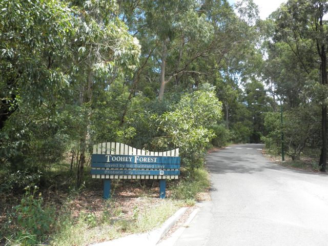
Toohey Forest is one of Brisbane’s most significant urban bushland reserves, accessible from both Tarragindi and Moorooka and home to a rich range of native wildlife. That ecological richness is precisely what makes fire ant management here so important.

Fire ants, known scientifically as Solenopsis invicta, arrived in Brisbane in 2001 via cargo ships from South America and have since spread across more than a million hectares of South East Queensland. Their sting causes a sharp burning sensation and can, in rare cases, trigger severe allergic reactions including anaphylaxis.

They pose a serious threat not just to people and pets but to native fauna, competing aggressively with ground-dwelling insects, birds and reptiles for food and territory.

Dense urban bushland like Toohey Forest is actually one of the harder environments for fire ants to establish in. Research suggests fire ants struggle to penetrate undisturbed forest with thick leaf litter, where native competitors and predators, including meat ants, green-headed ants, spiders and predatory beetles, can push back against them.

However, this natural defense is a double-edged sword. Research highlights that clearing land or using broad-scale baiting that inadvertently wipes out native ant populations can actually roll out the red carpet for fire ants. Maintaining the health of our native ‘ant-army’ is just as vital as the treatment itself. Protecting and treating a habitat like this is worth doing.

How the Treatment Works

The National Fire Ant Eradication Program treats all properties in an eradication area, whether fire ants are visible or not, and does so at no cost to landowners. In areas like this, properties may be treated up to six times over two years to ensure no nest is missed.

The treatment itself uses corn grit soaked in soybean oil, infused with a low-concentration insect growth regulator. Worker ants collect the granules and carry them back to the nest, where they feed them to larvae.

The larvae distribute the toxin through the colony by liquid feeding, and over several weeks the colony collapses. For an average suburban block, less than a teaspoon of insect growth regulator mixed with one cup of corn grit is all that is required.

Health authorities and the APVMA consider the treatment safe for people, pets, and the environment when applied strictly according to official guidelines. Because the bait is a targeted, low-concentration growth regulator rather than a broad-spectrum poison, it’s designed to hit the nest while leaving the wider ecosystem intact. 

Spotting Fire Ants in Your Area 

Residents who spot fire ants in gardens or along the forest edge must report the sighting to the National Fire Ant Eradication Program within 24 hours. Under the Biosecurity Act 2014, all Queenslanders have a general obligation to help prevent their spread.

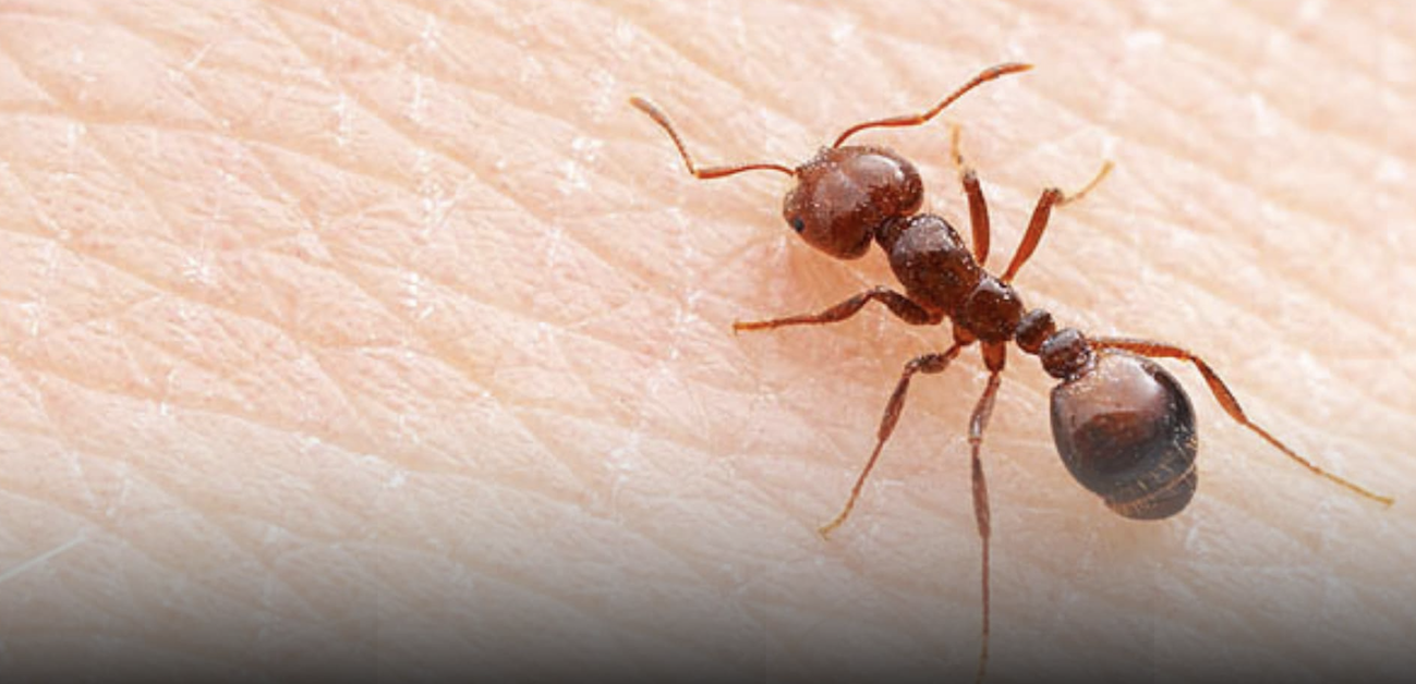
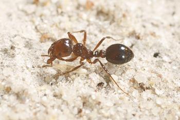
Fire ant nests are usually easy to identify. They form small mounds of loose, crumbly soil, up to 40 centimetres high, with no obvious entry holes. The ants themselves are copper-brown with a darker abdomen, ranging from two to six millimetres in size. When disturbed, they swarm quickly and aggressively.

Avoid disturbing or treating any suspected nest before reporting it, and keep children and pets well away from the area. While the bait is safe for pets if they come across it, it’s best to keep them away from treated areas so the ants have time to carry it back to the nest.

Report sightings by calling 13 25 23 or online at fireants.org.au.


Published 24-April-2026

Cycling Survey Highlights Safety And Access Issues In Tarragindi

Women and girls across Brisbane’s CBD and southside, including Tarragindi, are being invited to take part in a cycling survey examining riding habits, safety concerns, and access to local bikeways, with responses open until March 29.


Survey Focuses On Safety And Participation In Tarragindi

The survey is open to women and girls who ride regularly, occasionally, would like to ride, or do not currently ride. It is designed to gather insights into how people travel by bike and what factors influence their decisions.

Participants are asked about their current riding patterns and where they would prefer to travel by bike. Options include work, school, shops, public transport stations, parks, recreation areas, and visits to friends or family.

The survey also asks respondents to rate how safe they feel riding in their local area. It outlines common barriers such as unsafe roads, intersections and crossings, limited protected bike lanes, missing links between routes, poor lighting, and lack of facilities including bike parking.

Respondents are encouraged to identify specific streets, intersections or paths where safety concerns or missing connections affect their ability to ride. The survey also asks participants to nominate one location that could be improved to make riding safer.

Brisbane cycling survey
Photo Credit: Pexels

Tarragindi Cycling Network And Key Routes

Tarragindi is connected to a broader southside cycling network that supports both commuting and recreational riding. A key route is Veloway 1 (V1), a separated cycleway linking the area with the Brisbane CBD while allowing riders to avoid general traffic.

Stage E of the Veloway 1 upgrade improved connectivity, including bridge works at Marshall Road, Sterculia Avenue and Bapaume Road. The route is intended to support safer travel and encourage active transport use.

The Tarragindi Bikeway starts near Evans Road and Orange Grove Road and connects with Toohey Forest and the V1. Toohey Forest Park provides additional off-road trails through bushland terrain used for mountain biking.

Nearby facilities include the Glindemann Park BMX and pump track in Holland Park. A 7.1-kilometre circuit along the Warick Creek and Bulimba Creek bikeways offers an option for both commuting and leisure riding.

Tarragindi cycling
Photo Credit: Pexels

Next Steps For Cycling Insights

The survey is aimed at building a clearer understanding of how women and girls experience cycling across Brisbane’s southside, including Tarragindi. It asks participants to identify locations where infrastructure and conditions affect their riding decisions.


Tarragindi’s cycling network provides access to both commuter routes and recreational trails, while the survey seeks to identify where improvements may support increased participation.

Published 19-Mar-2026
Wildlife Underpass And Fauna Fencing Added On Toohey Road

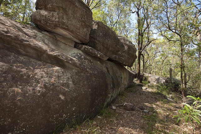
A newly completed wildlife underpass beneath Toohey Road is designed to help koalas and other native animals move safely between habitat areas within Toohey Forest, while reducing the risk of wildlife entering traffic lanes.


Why The Underpass Was Built

Project information outlines the underpass as a measure to minimise animal crossings across Toohey Road and improve safety outcomes for both motorists and fauna. The location sits within a connected habitat area linked to Toohey Forest, where maintaining movement between food sources and shelter areas is considered important for wildlife resilience and survival.

The project also aims to strengthen habitat connectivity, allowing animals to move more freely between bushland areas and reducing the likelihood of animals attempting to cross the road surface.

habitat connectivity
Photo Credit: CrSteveGriffiths/Facebook

What Was Installed

The underpass includes a 2.4-metre by 2.4-metre culvert installed beneath Toohey Road, positioned southwest of the Toohey Picnic Area. Inside the culvert, a raised log pole frame was constructed to provide a bridge-style option that allows animals to move through the crossing without travelling directly along the ground.

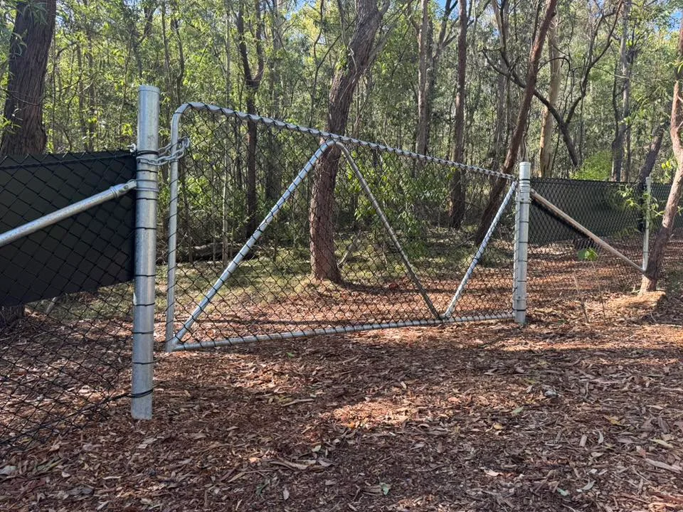
Mulch and natural materials were placed at the base of the culvert to help the structure blend with the surrounding environment and encourage wildlife to use the crossing. Fauna fencing with wildlife escape hatches was installed on both sides of the road to guide animals towards the underpass and away from traffic.

Construction Timing And Access

Construction commenced in mid-November 2025 and was completed within the expected two-month timeframe. Works were undertaken between 7 p.m. and 5 a.m., Sunday to Thursday, to minimise traffic disruption. Toohey Road was fully closed from 8 p.m. Friday 14 November to 5 a.m. Monday 17 November 2025, with detours in place, including via Tarragindi Road. 

Vegetation Management

Some tree and vegetation removal was required to allow installation of the culvert and fencing. The project design includes replanting native vegetation selected to support local wildlife habitat, with specialist input guiding vegetation management.

Community Feedback And Next Steps


Community responses have included questions about fencing design and long-term performance. A site walk-through has been flagged to identify any gaps or defects in the fencing near the underpass, with repairs planned where needed to ensure the crossing functions as intended.

Published 15-Jan-2026
Toohey Forest BioBlitz Doubles Brisbane’s Species Count

When scientists and volunteers took to Toohey Forest for a weekend survey, they documented part of a rich ecosystem hidden in plain sight at the forest, home to more than 500 species.


Community Effort in Action

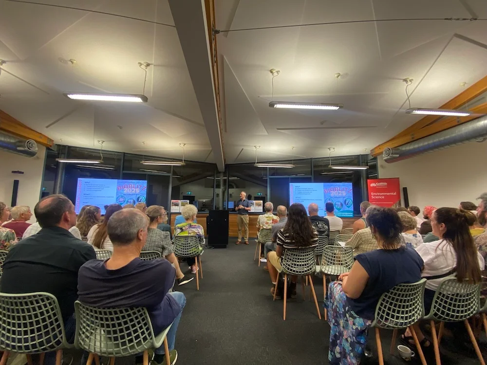
Between 5 and 6 September 2025, more than 80 volunteers joined Griffith University researchers for the Toohey Forest BioBlitz. This two-day survey invited everyday nature lovers to help document the forest’s rich ecology.

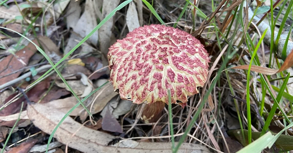
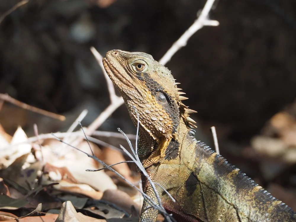
Using the app iNaturalist, they photographed plants, insects, birds and fungi across the campus and surrounding bushland. In total, they recorded 4,166 observations and identified 516 unique species, nearly doubling the site’s previously known biodiversity record.

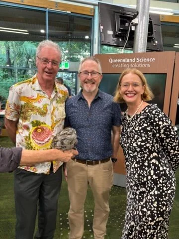
Lead organiser Wade Hadwen from Griffith’s School of Environment and Science said the data not only mapped the forest’s ecological health but also created a valuable baseline for future monitoring. The project was run in partnership with the Griffith EcoCentre, with community engagement at its core. Many participants were new to biodiversity surveys, yet their observations significantly expanded scientific records of the area.

Photo Credit: Griffith University/LinkedIn

Findings That Matter

Among the hundreds of records were sightings of endangered and vulnerable wildlife, including the Koala and the Powerful Owl. The findings confirmed that Toohey Forest still supports species of conservation concern despite sitting within metropolitan Brisbane.

Specialists and enthusiasts working across plant, insect and fungi groups helped uncover major data gaps, especially among smaller species such as spiders, beetles and fungi.

Photo Credit: Griffith University/LinkedIn

Griffith University noted that the expanded dataset could inform management of the forest, including habitat protection, fire control and biodiversity planning. The results also showed how collaborative research can reconnect urban residents with the natural world in their own backyard.

A Baseline for the Future

Hadwen explained that Toohey Forest acts as a “biodiverse island oasis” surrounded by urban development, making it an ideal site to track how ecosystems adapt to environmental pressures. Organisers said the success of this first BioBlitz could pave the way for ongoing volunteer monitoring programs that continue to build on the dataset.


Participants reported the experience as educational, with many saying it strengthened their connection to the local environment. The BioBlitz has become a model for community-driven conservation, blending academic research with public participation to protect one of Brisbane’s last remaining forest corridors.

Published 22-Oct-2025

Popular Toohey Forest Walking Tracks to Reconnect with Nature

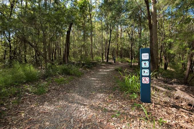
Considered as one of the few remaining “green lungs” in Brisbane, Toohey Forest is not just home to a number of native plants and animals, but it also boasts an extensive network of both paved and unpaved walking tracks. 

Photo credit: Brisbane City Council / brisbane.qld.gov.au

Toohey Forest was named after James Toohey, an Irish-born who amassed wealth in the California gold rush and bought this land in 1870. His descendants held the land until the Council acquired it in 1945. 

Photo credit: Brisbane City Council / brisbane.qld.gov.au

Spanning approximately 260 hectares and just 10 kilometres from the CBD, Toohey Forest offers a perfect place for a family outing with a number of barbecue and picnic areas: Gertrude Petty Place, Mt Gravatt Outlook picnic area, and Mayne Estate and Toohey picnic area. 

Photo credit: Brisbane City Council / Flickr

There are 30 intertwining cycling and walking tracks of varying difficulty spread throughout the forest, with the longest track just 3.5 kilometres long and the shortest being just 250 metres. 

Photo credit: Brisbane City Council / Flickr

Toohey Forest ideed has some of the best spots for walking, biking, picnicking or just spending a lazy afternoon. Needless to say, you will be rewarded with marvelous views of Brisbane and its surrounding suburbs from Mt Gravatt Outlook.

Photo credit: Brisbane City Council / Flickr
Toohey Forest Walking Tracks
Photo credit: Brisbane City Council / Flickr
Toohey Forest Walking Tracks
Photo credit: Brisbane City Council / Flickr

Popular Toohey Forest easy to moderate walking tracks

  • Nathan Ridge Track – Prepare to spend about one hour walking through this  paved 3.5km track that leads from Toohey Ridge and connects to the Griffith University Campus ring road.
  • Toohey Ridge Track – Rated as easy walking, this three-kilometre track runs from the Toohey picnic area along the ridgeline and leads to the South East Freeway.
Toohey Forest Walking Tracks
Photo credit: Brisbane City Council / Flickr
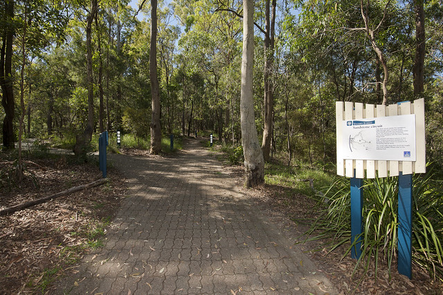
  • Sandstone Circuit – This 750-metre short track begins at the Toohey picnic area then follows a winding path through the forest. This is a moderate walking track with bench seats available to take a breather along the way.
  • Toohey Mountain Track -The journey along this 1.5km track starts from Mayne Estate picnic area and follows the ridge southwards to Pegg’s Lookout.
  • Summit Track – Summit track begins at Gertrude Petty Place then leads to Mt Gravatt Outlook. It stretches 1.2 kilometres and will take about 40 minutes to traverse it by walking.

Don’t forget to prepare for slippery and rough tracks by wearing protective footwear. Also, wear a hat and loose, long sleeved shirts and trousers to avoid scratches, bites, and sunburn. 


Community Walk and Talk Supports Local Mothers in Tarragindi

A local walking event in Tarragindi is providing a supportive space for mothers, children and families to connect through shared experiences and breastfeeding support.


Community Connection Through Walking in Tarragindi

Mothers, children and families are gathering in Tarragindi for a pram-friendly walk through Toohey Forest, offering a relaxed setting for social connection, shared parenting experiences, and breastfeeding support.

The event is scheduled for Wednesday, 17 September 2025, at Shaftesbury Street Park on Laura Street, with the group meeting at 9:45 a.m. in the Toohey Picnic Area. Participants will follow the accessible Toohey Ridge Track, covering approximately 3 kilometres, before returning for a snack and informal chat in the picnic area.

breastfeeding support
Photo Credit: Pexels

Background and Purpose

The initiative forms part of a regular local gathering and marks the final catch-up for the term. Organisers are encouraging participation from women with prams, older children, and families, creating an inclusive environment focused on physical activity and community bonding.

The event also provides access to a trained breastfeeding counsellor, aligning with broader efforts to support families on their breastfeeding journey.

Support Aligned with National Vision

The event is supported by the Australian Breastfeeding Association (ABA), which aims to normalise breastfeeding across Australian society. ABA is recognised as the national authority on breastfeeding education and support, providing services such as a 24-hour helpline, online resources, antenatal classes and trained peer support.

More than 1,000 volunteers, most of whom are mothers with firsthand experience, deliver ABA’s services. Many of these volunteers are qualified through a Certificate IV in Breastfeeding Education.

 community walk
Photo Credit: Pexels

Peer Support and Local Engagement

The Tarragindi event aligns with ABA’s strategic priorities, including community-based breastfeeding support and promotion of inclusive, breastfeeding-friendly environments. By bringing together families in an informal setting, the event encourages social support networks while providing access to accurate and evidence-based breastfeeding information.

Participants are encouraged to share personal experiences and offer encouragement to others who may be seeking support.

Ongoing Engagement


While the event marks the final local meeting for the current term, families attending have opportunities to continue engaging with ABA programs and services throughout the year. Information on upcoming gatherings and resources is available through local contact points.

Published 15-July-2025